

Wokha Travel and Tourism Guide
In the year, the British Government occupied Wokha as the District Hq. of Naga Hill under Assam.In the year 1878, the Hq was shifted to Kohima and Wokha remained as Sub - Division. Again in 1889, the Sub - Division was shifted to Mokokchung. Only in the year 1957, when Mokokchung became a District through the creation of NHTA Wokha again became a Sub - Division. During the first General Election of January 1964, there were Five (5) Assembly Constituencies in the Sub - Division among the total of 40 Constituencies for the State of Nagaland, then Mon, Tuensang were under the direct supervision of the Governor for a limit of 10 years 1973, Wokha District was created and the third General Election was held in 1974, with the additional 20 Constituencies for Tuensang and Mon District. It was during this election, in the re - distribution of constituencies, the number of Assembly Constituency for the Wokha District was reduced to 4 and it remains till date. The Wokha District is situated in the mid western part of Nagaland State, adjacent to Sibsagar plain of the Assam State. It is bounded by Mokokchung District in the North, Kohima District in the South. Zunheboto District in the East and the State of the Assam in the West. The Wokha District is situated at a latitude of 26° '8' North and a longitude of 94° '18' East.
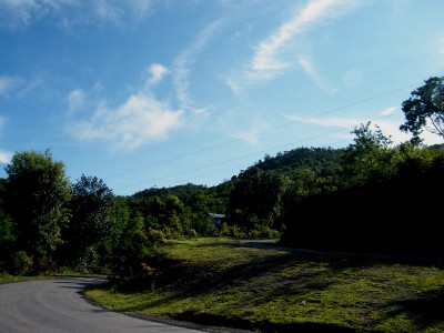
The Topography of the district is more or less similar with that of other district in the state, having ranges and ridges di-sected by seasonal streams. the altitude ranges from 304.3 Mtrs to 1313.67 Mtrs (MSL). The climate is warm in the lower plain areas, moderately warm in the upper region during summer but cold in winter. The monsoon starts from May and continues till October. The annual rainfall varies from 200 cmto 250 cms. The District is divided into three (3) ranges, which are as follows: -
1. Wokha Range or Upper Range, which falls in the upper North Eastern parts of the district.
2. Sanis Range or Middle Range, which covers the middle part of the district.
3. Bhandari Range or Lower Range is the outer most part of the district which extents from the Japukong range of Mokokchung District and gradually slopes down to the Assam plains in the North Western side. Two of the most fertile valleys are in this range and they are the Baghty and churung valleys.
The highest mountain peak is the Tiyi Enung, with an altitude of 1970 mtrs. Important rivers which flow through the District are Nzhu and Nruk. The district lies in a seismically active earthquake zone
Wokha is also famous for fruits like Oranges, Passion fruits, Plum and Bananas. The soil types are recent Alluvium, old Alluvium Mountains valley Lateritic soil, brows forest and podzolic soils.
Agriculture and allied activities are the principal means of livelihood for the vast majority of the population residing in the rural area. Rice is the major food crop and occupies 77% of the total cultivable area. Other major crops grown are maize, tapioca, pulses, soya beans and variety of organic vegetables, which are available in the local market year around.The staple food diets of the people are Rice, Bamboo shoot of various types, fermented of dried fish, yam, Molasses, Vegetables and meat, which is a delicacy. Foods are mostly boiled and species are rarely used. They are very particular, both in their food preparation and habit of taste. The people of the district also practice certain traditional cottage Industries mostly during the off season to meet their local requirements, like black smithy, traditional weaving, carpentry and handicraft etc. minerals like coal and cude oil are found at Changpang area in the lower range. If you visit Wokha in the month of November, you will surely enjoy the hospitality of the people during their Principal festival"TOKHU EMONG" which celebrates thanksgiving, sharing and reconciliation with great feasting.